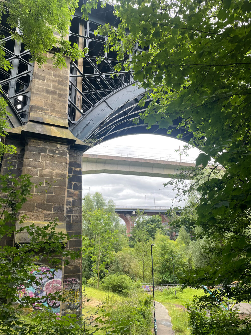
Furthest from the camera is the 1878 Byker Bridge, originally a toll bridge—though the charge was removed in 1895. It carries the road now designated the A193.
In the middle is the newest of the three, Arup’s much-celebrated 1970s curving concrete Byker Viaduct, with joints glued together. It carries the Tyne & Wear Metro between Manors and Byker.
Though people assume he was born in Denmark, Arup’s founder, Ove Arup, was in fact born a stone’s throw from the bridge in Heaton. He was born in 1895: closer in time to the construction of the two preceding bridges than the one his firm designed. He had retired by the time the firm took on the Byker Viaduct project.
I’ve read Diamond Geezer’s blog for many years. He’s been blogging for a similar number of years to me, though is much better at it, not least in terms of consistency of posting.
For yesterday‘s post, on one of his many lockdown walks around his part of London, he decided to take a picture every twenty minutes. It sounded like a fun diversion, so I thought I’d do the same: an aimless ramble starting in Gosforth, my part of Newcastle, in somewhat less than clement weather.
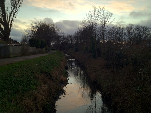
20 minutes
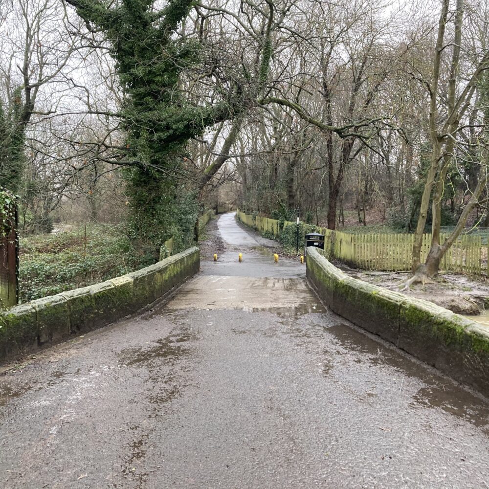
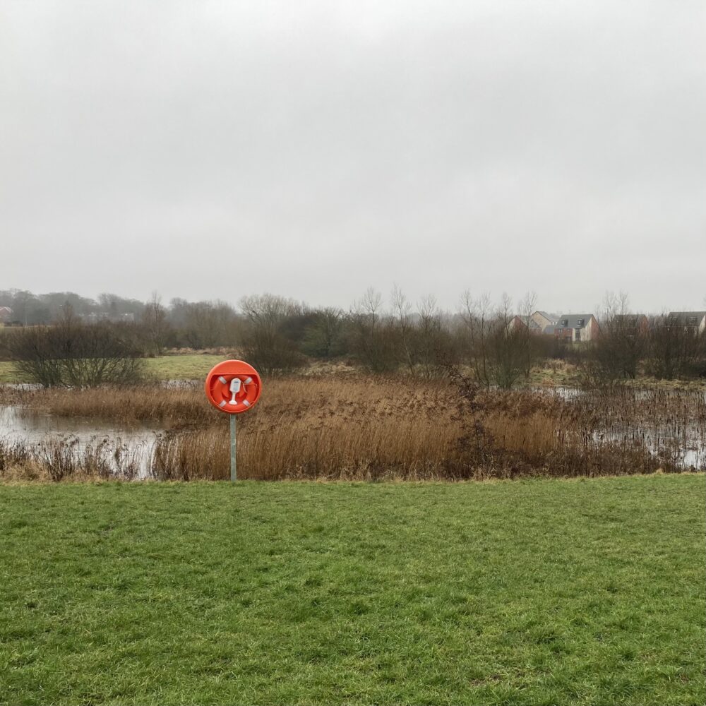
Twenty minutes after leaving home, I found myself at Dentsmires Bridge across the Ouseburn. Just out of shot to the right are two men from the Environment Agency, looking concerned about the water level.
This bridge connects Woodlea Gardens, a residential street, to Heathery Lane, a now mostly pedestrianised track originally so-called as it cut across heathland, but which now mostly cuts across golf courses.
The proportion of Gosforth’s green areas which are given over to golf courses, serving a small minority of the population, is a topic I occasionally find irrationally aggravating. Not today, though: not only are golfers barred from enjoying the course by covid restrictions, the week’s rainfall has left the course so waterlogged that it may be some time before it’s usable again.
The Ouseburn is significant not just because I’ll pass it several times on my route today, and not just because I’ve blogged about it plenty of times, but also because it underlies the name “Gosforth” (though not obviously). The name comes from “Gese Ford”—a ford across the Ouse.
40 minutes
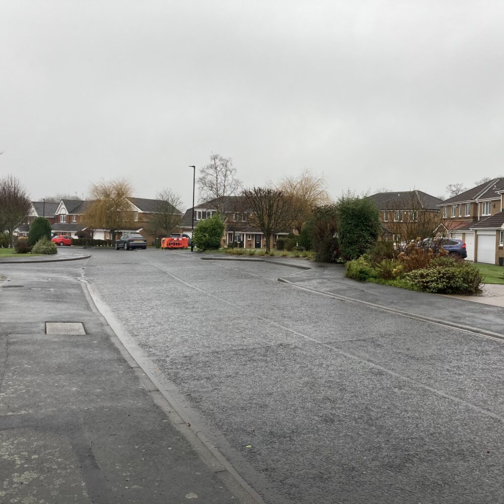
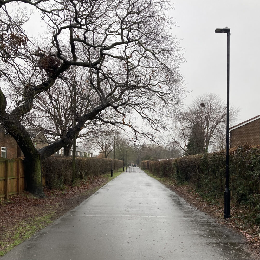
A flooded footpath on my rambling route beyond Heathery Lane meant some unplanned doubling back and a diversion through Whitebridge Park, a relatively recent addition to Gosforth which started to be built in the 1980s.
When house-hunting, Wendy and I were put off this area because of the slightly uncanny quietness of its many cul-de-sacs, and this remained true today: the only evidence of human life as I ambled through was a man eating a sandwich in a broadband van.
Whitebridge Park is also home to a play area which I think may be in the running to be Britain’s most depressing.
1 hour
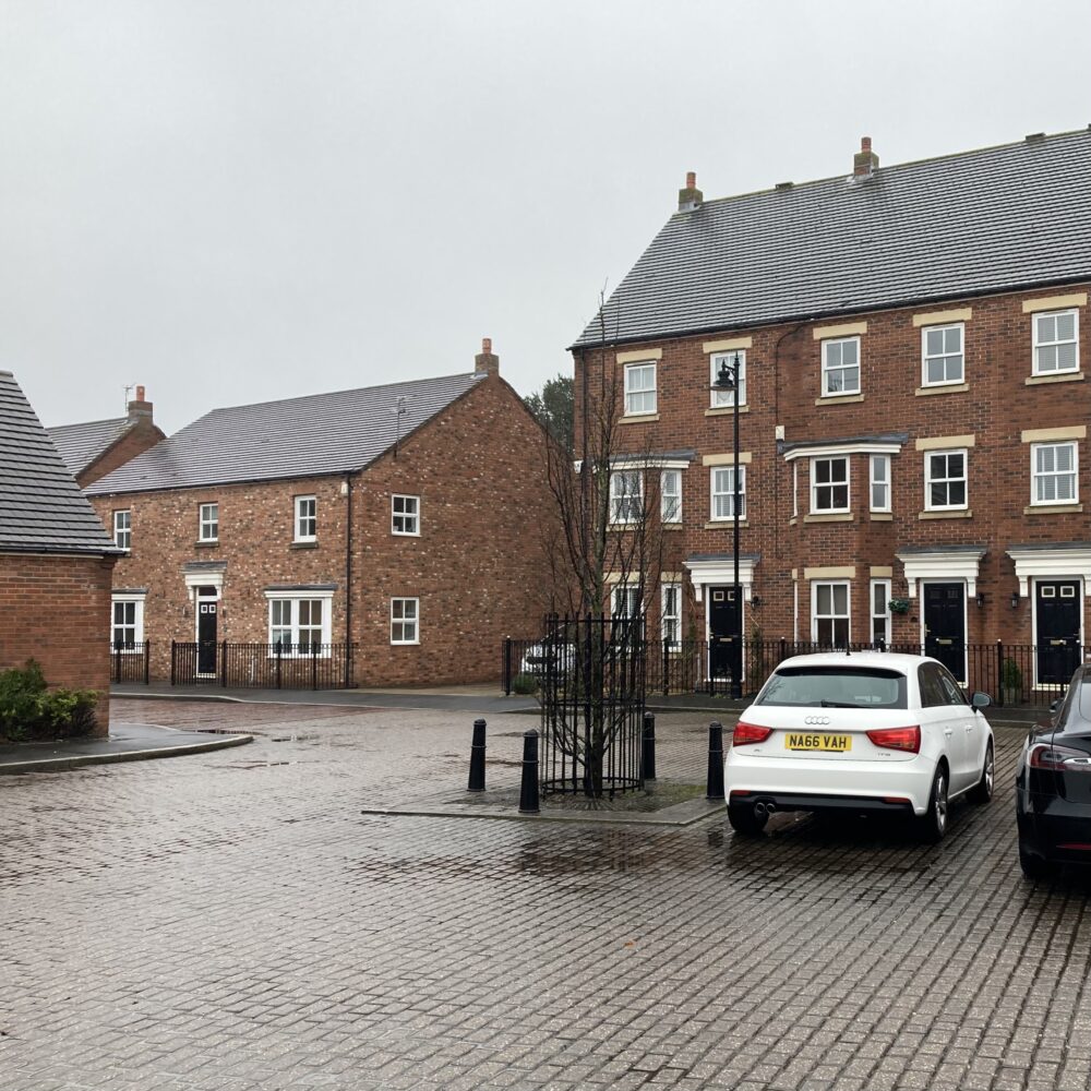
After meandering through the 1960s Melton Park and past the thousand-year-old ruins of North Gosforth Chapel, burned down some five-hundred years ago, I found myself in Newcastle Great Park. With a grand plan from the early 2000s to build more than 4500 homes over a forty-year period, Great Park is a massive development—and not without controversy.
Here at Warkworth Woods, the first bit to be developed, the developers decided to cobble parts of the roadway, presumably to add to a ‘village-like’ aesthetic.
1 hour 20 minutes
Having crossed the A1, I reached the newer part of the Great Park development. Here, the world headquarters of the software giant Sage occupies a huge office—though not for much longer—and a school catering for thousands of pupils is due to open later in the year.
I skirted around most of the housing in this part of the development, sticking with the paths through the green areas (or, as the developers would have it, the “diverse mosaic of woodland, meadowland and network of drainage systems with hills, vales and streams”). These include a few patches of reedy bodies of Ouseburn water. On nicer days, this area is frequently busy with dog-walkers.
1 hour 40 minutes
With unfortunate timing, twenty minutes of further walking brought me to this rather unexciting pedestrianised route across the area known as Brunton Bridge. Speaking of bridges, however, I did have to cross the raging Ouseburn once again to get here.
2 hours
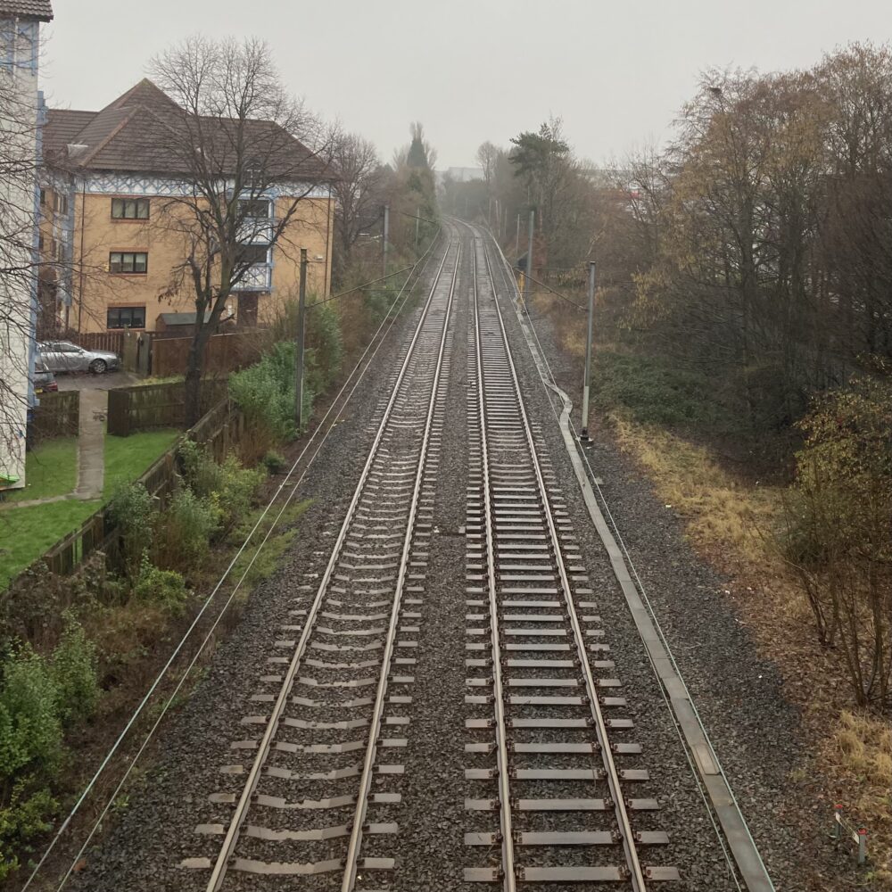
The two-hour mark saw me crossing the Metro line near Fawdon, with an excitement only slightly tempered by having previously crossed a different part of the line only ten minutes earlier. This track route dates back to the Ponteland railway constructed in the early 1900s, which closed to passengers in 1929. It continued to serve freight, however, including the then-Rowntree now-Nestlé factory which is just behind the trees on the right of the photo above. It now makes Toffee Crisps. It might also make other things, but Toffee Crisps are unbeatable in my book.
The line carried passengers once again from 1981, when the Tyne and Wear Metro started operating along this stretch.
To get here, I also had to nip across the A1 again. The history of the A1 in the North East is surprisingly involved. When this section opened in 1993, it was the third bit of road on this latitude designated as the A1 in just sixteen years.
2 hours 20 mins
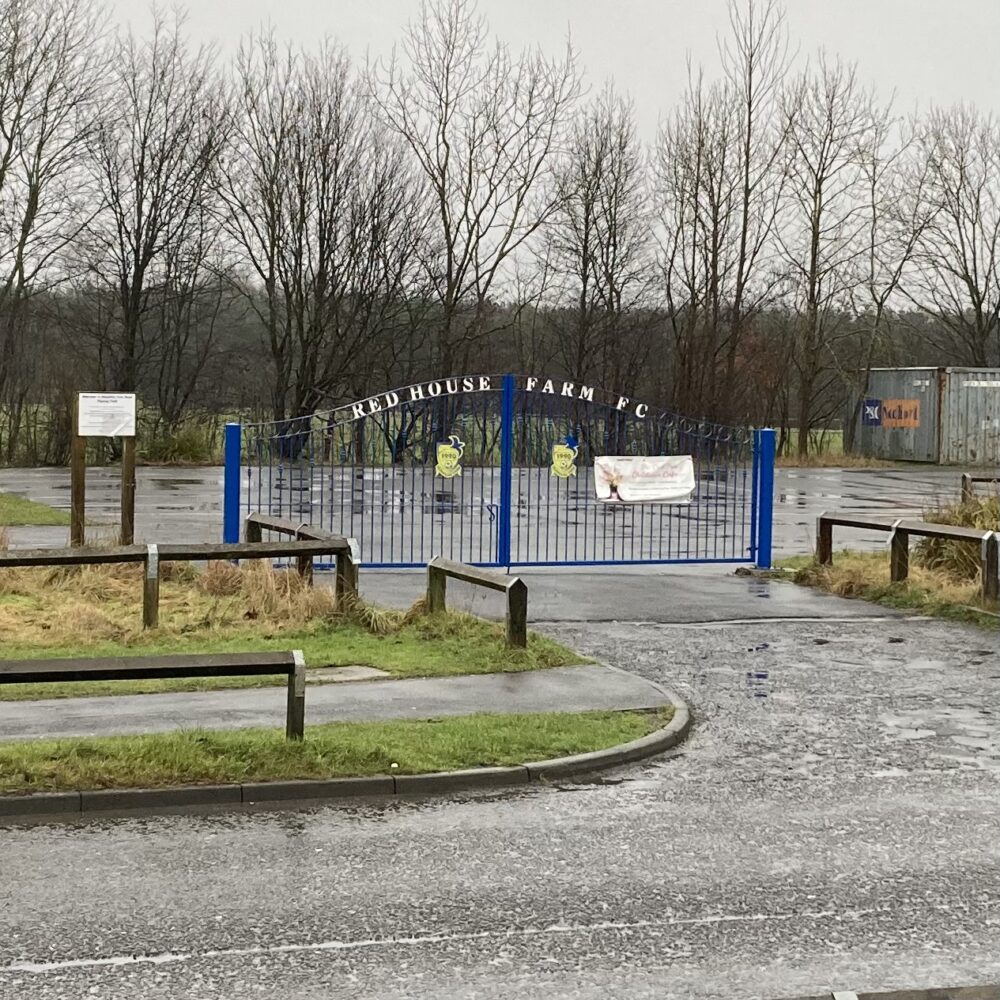
Red House Farm is an area whose history is all in the name: a residential development on what used to be a farm, of which essentially all that remains is an eighteenth-century farm house, which today’s route didn’t pass.
The Red House Farm Junior Football Club does what it says on the tin gates, having started in 1990 and since taking on hundreds of 6-19 year-old players, many of whom have gone on to be professional players.
2 hours 40 mins
Twenty minutes earlier than DG, I’m back home and slowly drying out.
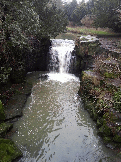
When I did photo-a-day in 2012, I got a lot of stick for the number of times I featured the Ouseburn… so where better to start a new series! Today’s photo shows the Ouseburn as it flows through Jesmond Dene.
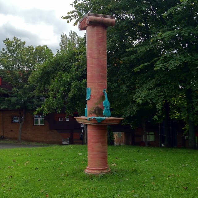
Tonight’s the Last Night of the Proms, so I thought it would be appropriate to feature something musical. This is Roman Bar Column, one of a number of bottle-themed waymarkers in the Ouseburn Valley created by local Fine Art graduate Lewis Robinson. I say he’s a Fine Art graduate, but that was nearly a quarter of a century ago, and he’s done an awful lot since then.
Here’s a closer look at that violin:
Now I did say that these sculptures were bottle-themed, and you might be wondering how this ties in. Well, on the other side of the sculpture, you’ll find this:
When the sculpture was first plonked here in 2002, this was a neat visual pun as it was opposite one of Byker’s most famous pubs, The Plough Inn, which dated back to the late 1800s. Unfortunately, this closed down a few years ago, and the building is now occupied by Albaik, a (highly rated) Lebonese restaurant. This rather ruins the gag.
Now, given that I was at the top of the Ouseburn Valley, and given this blog’s history, how was I supposed to resist a picture of the Ouseburn?
This was taken from the top of Byker Bridge, and shows the river curving round Ouseburn Farm. There’s more about Byker Bridge, and some photos from the bottom, back on day 224.
Over the course of this photographic year, I’ve featured lots of bits of the Ouseburn, a local river that runs from its source, near Newcastle airport, to the Tyne, near the famous Quayside. It also passes fairly near my house.
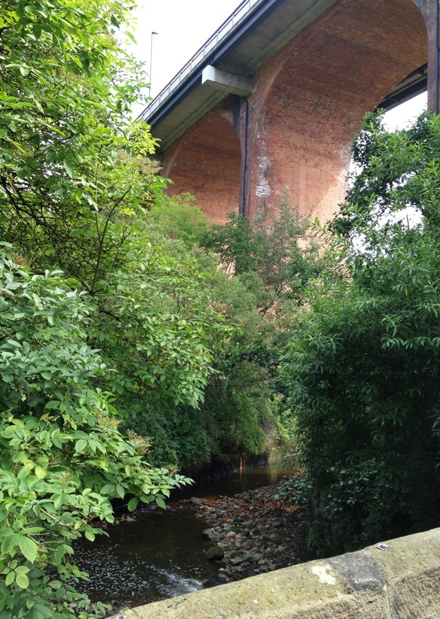
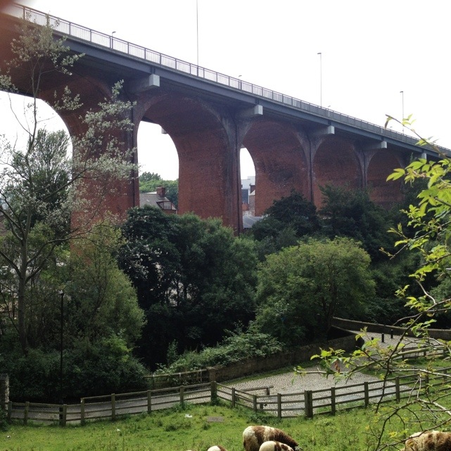
I’ve featured it so many times now that I know it’s become a groan-worthy subject for some: Wendy included! But today, I wanted to show you the Ouseburn at Ouseburn: the point at which the river flows through its namesake part of Newcastle, in the Ouseburn Valley. This is it flowing under the huge Byker Bridge:
The Byker Bridge was opened in 1878, and, in something resembling current Government policy, its construction was funded by a toll charged for use until 1895. It was designed by Robert Hodgson, who was better known for his rail bridges. It is built entirely of brick, and is almost 100ft tall and over 1000 feet long. This picture gives a better sense of scale:
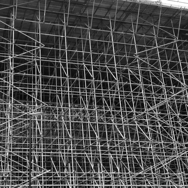
Perhaps the more interesting construction which lies almost alongside Byker Bridge is the Ouseburn Viaduct, which carries the East Coast Mainline. It was – remarkably – originally a timber construction built in 1839. Thirty years later, the timber was switched to iron. Unfortunately, the viaduct is currently undergoing a £10m restoration, and so all that can be seen today is a web of scaffolding:
I’ll have to visit again when the work is complete… Ouseburn will be back!
Today’s photo shows another bit of the Ouseburn, on its meandering path from somewhere near Newcastle Airport to the Tyne.
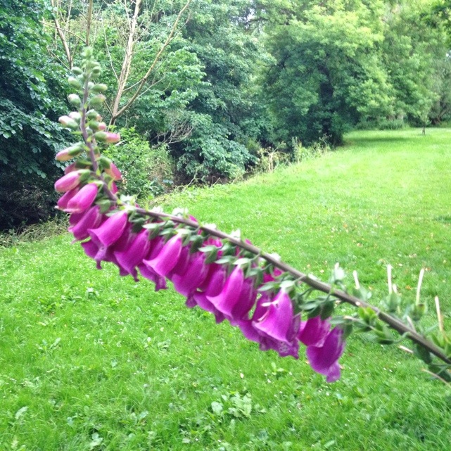
I’ve featured various bits of the Ouseburn in the last 190 days, and Wendy reckons it’s now become boring and repetitive. She suggested I photograph and feature this foxglove:
So two for the price of one today: the Ouseburn and a foxglove!
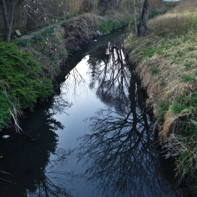
I’ve featured three shots of the Ouseburn previously – and today’s photo is the fourth, from the fourth different location! This one’s just a little bit downstream from this one. At this rate, I might have photographed every centimetre of its course by the end of the year!
The content of this site is copyright protected by a Creative Commons License, with some rights reserved. All trademarks, images and logos remain the property of their respective owners. The accuracy of information on this site is in no way guaranteed. Opinions expressed are solely those of the author. No responsibility can be accepted for any loss or damage caused by reliance on the information provided by this site. Information about cookies and the handling of emails submitted for the 'new posts by email' service can be found in the privacy policy. This site uses affiliate links: if you buy something via a link on this site, I might get a small percentage in commission. Here's hoping.